We woke to rain on the tents and traded stories about the night sounds. The skies looked gray and threatening.
We retraced our steps to the highway heading to North Bay. It was a new highway with a good shoulder and with a bit of a following wind we made good time going through place names on the map (Coniston, Wahnaptae) towards Hagar where we had been told there was a restaurant. Brenda phoned to say that it was several kilometers further than that. Meanwhile the shoulder on the road deterioted again with the white line actually going through a pothole or going off the road surface with a 4 inch drop!
The restaurant at the Brunet Truck Stop was owned and managed by a young Mennonite named Kate; the service and food were great and she was genuinely amazed at what we were doing "at our ages".
When we got to the Dutrisac Cottages and Campsite on West Lake Nipissing it didn't take us long to decide to have our rest day here rather than in North Bay as planned. This is a real holiday spot ...... the water is warm and shallow with a sandy bottom. It has the right atmosphere for our day of rest.
Tuesday, July 22, 2008

Day 56, Sunday, July 20, Sudbury, 103 km
Since we had not had decent coffee in the morning (no power) we stopped in Webbwood just 10 km down the road. The Old Vault is open for breakfast from 6 a.m. and the menu played up the history of the area.
After 43 km we came to Nairn Center which had bathrooms for us. At some point we pulled off at Blueberry Station which was a closed up gas station/diner to eat our lunch in the shade. We have found so many "for sale" or "closed" signs along the highway in Ontario; it is quite worrying aside from the fact that we can't rely on food being available.
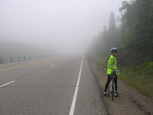
Traffic was bumper to bumper today and the highway's shoulder was very narrow and full of holes and deep ruts. It was the worst day of cycling we've had with all our mental and physical energy focussed on not getting in trouble.
Brenda had told us not to go Hwy #55 as we approached Sudbury (in fact, she suggested that we not visit Sudbury as we had originally planned) as it was rough and had no shoulder. However, we came to a divided highway and to the "no cycles" sign and had no choice. But it certainly was quieter and had less traffic so we started to relax.
Eventually after kilometers of new highway and overpasses and no scenery except gravel we came to Carol's Campground which is on Richard Lake, 3 km south of Sudbury.
Later in the afternoon the caravan with the two marathoners arrived....we had been playing leapfrog with them for part of the day. They are each doing a marathon a day in legs of 5 or 10 km at a time; they seem to be well-sponsored.
I think that all of us spent the evening recovering from the terrible cycling conditions.
posted by Yvonne
After 43 km we came to Nairn Center which had bathrooms for us. At some point we pulled off at Blueberry Station which was a closed up gas station/diner to eat our lunch in the shade. We have found so many "for sale" or "closed" signs along the highway in Ontario; it is quite worrying aside from the fact that we can't rely on food being available.
Traffic was bumper to bumper today and the highway's shoulder was very narrow and full of holes and deep ruts. It was the worst day of cycling we've had with all our mental and physical energy focussed on not getting in trouble.
Brenda had told us not to go Hwy #55 as we approached Sudbury (in fact, she suggested that we not visit Sudbury as we had originally planned) as it was rough and had no shoulder. However, we came to a divided highway and to the "no cycles" sign and had no choice. But it certainly was quieter and had less traffic so we started to relax.
Eventually after kilometers of new highway and overpasses and no scenery except gravel we came to Carol's Campground which is on Richard Lake, 3 km south of Sudbury.
Later in the afternoon the caravan with the two marathoners arrived....we had been playing leapfrog with them for part of the day. They are each doing a marathon a day in legs of 5 or 10 km at a time; they seem to be well-sponsored.
I think that all of us spent the evening recovering from the terrible cycling conditions.
posted by Yvonne
Day 55, Saturday, July 19, Massey (Chutes Prov. Park), 100 km
We woke to a heavy dew after a sleep filled with the sound of trucks going all through the night. It was cooler which made for pleasant cycling.
We had arranged to meet Brenda for coffee at Algoma Mills. Even though Blind River came first and seemed like a town filled with civic pride (tubs filled with petunias, a fountain in the river, and a large statue by the roadside) we bypassed it as a coffee place though some took advantage of the farmers' market. When we got to Algoma Mills we found that it was essentially a beer store and not much else.
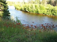
We had followed a wide, slow-moving river earlier in the day and for lunch stopped at Serpent River which had a rapids and open water lilies....quite lovely. We later stopped for coffee and ice-cream in Spanish before reaching Massey.
Massey was a busy little town, full of participants in the following day's marathon (starting at 6 a.m.), half-marathon and 10 k run. We stayed at Chutes Provincial Park which is like a campsite should be.....we loved seeing the families on their holidays.
It was a sad afternoon for us though, as Serge and Stefan, after not finding any accommodation in town, had to go on to Espanola. We will miss their energy and enthusiasm and wish them a safe journey to the Toronto area.
Later in the evening Roland, a fellow cyclist on his own since Winnipeg, came over for a beer. He told us of the horror of the Trans-Canada west of Winnipeg and that he left it after Winnipeg. We were even more pleased with our choice of routes through Manitoba after hearing his story.
We had arranged to meet Brenda for coffee at Algoma Mills. Even though Blind River came first and seemed like a town filled with civic pride (tubs filled with petunias, a fountain in the river, and a large statue by the roadside) we bypassed it as a coffee place though some took advantage of the farmers' market. When we got to Algoma Mills we found that it was essentially a beer store and not much else.
We had followed a wide, slow-moving river earlier in the day and for lunch stopped at Serpent River which had a rapids and open water lilies....quite lovely. We later stopped for coffee and ice-cream in Spanish before reaching Massey.
Massey was a busy little town, full of participants in the following day's marathon (starting at 6 a.m.), half-marathon and 10 k run. We stayed at Chutes Provincial Park which is like a campsite should be.....we loved seeing the families on their holidays.
It was a sad afternoon for us though, as Serge and Stefan, after not finding any accommodation in town, had to go on to Espanola. We will miss their energy and enthusiasm and wish them a safe journey to the Toronto area.
Later in the evening Roland, a fellow cyclist on his own since Winnipeg, came over for a beer. He told us of the horror of the Trans-Canada west of Winnipeg and that he left it after Winnipeg. We were even more pleased with our choice of routes through Manitoba after hearing his story.
Day 54, Friday, July 18, Iron Bridge, 113 km
We left Sault Ste Marie via the old highway as bicycles are not allowed on the new divided highway. Fortunately this was good for us as the highway was quiet though the scenery was not idyllic. We were looking for a bathroom break when we came to a store somewhat like a Buckerfield's. Upon leaving Adele noticed that Udderly Smooth was for sale by the counter for the price of $3.29, a bargain which some of us took advantage of.
We made relatively good time as there was a bit of a tail wind, the hills were not high and we had no places to stop for coffee or second breakfast. We're learning that a name on the map doesn't mean services are there.
We stayed at the Viking campground two kilometers short of Iron Bridge.
We made relatively good time as there was a bit of a tail wind, the hills were not high and we had no places to stop for coffee or second breakfast. We're learning that a name on the map doesn't mean services are there.
We stayed at the Viking campground two kilometers short of Iron Bridge.
Thursday, July 17, 2008
Day 53 - Thursday, July 17 - Rest Day
As we all know '60 is the new 59'. Guess who???
Happy Birthday today to Dave3.
Happy Birthday today to Dave3.
Day 52, Wednesday, July 16, Sault Ste. Marie, 122 kms.
The thought of a ‘day off’ obviously spurred the group on, as we didn’t have our first serious stop for some 45 km. We were told there would be some hills, especially ‘Blueberry Hill’. After we climbed that one, Pat remarked that we should take note of any hill with the name “Blueberry" in it. The last one was the Blueberry-Paulson pass and it was a real climb.
There was a long gentle slope down into Sault Ste. Marie, which made the last 20 km very easy. We all settled into a Hotel to get a break from the bugs. This will be the last we see of Lake Superior. Regrettably there is no Starbuck's to be found in Sault Ste. Marie ;(
The next day will be a rest day.
Some personal observations to this point in the trip. Parts of BC are doing very well as is southern Alberta. Saskatchewan is just starting to boom with the discovery of oil and gas in the Weyburn area. Northern Ontario is really struggling. It seems like every second camping spot and restaurant is for sale. Also, the traffic seems extremely light on the Trans Canada Highway likely due to the large reduction in tourists this year.
It is great when people honk and wave to us as they go by. The happy honks seem out way the mad honks by about 10 to 1.
Dave 3
There was a long gentle slope down into Sault Ste. Marie, which made the last 20 km very easy. We all settled into a Hotel to get a break from the bugs. This will be the last we see of Lake Superior. Regrettably there is no Starbuck's to be found in Sault Ste. Marie ;(
The next day will be a rest day.
Some personal observations to this point in the trip. Parts of BC are doing very well as is southern Alberta. Saskatchewan is just starting to boom with the discovery of oil and gas in the Weyburn area. Northern Ontario is really struggling. It seems like every second camping spot and restaurant is for sale. Also, the traffic seems extremely light on the Trans Canada Highway likely due to the large reduction in tourists this year.
It is great when people honk and wave to us as they go by. The happy honks seem out way the mad honks by about 10 to 1.
Dave 3
Day 51, Tuesday, July 15, Montreal River, 118 km
This is a day from the RV driver’s perspective. Went into Wawa for the second time (since yesterday’s shopping expedition) to go to a pharmacy for necessities and get some more bread because our next stop has no store. So got to drive past the 30 foot Canada Goose statue, and 2 others almost as large in the town, again. Had an urgent call on my cell saying someone had trouble with their bike, turned out Serge’s bike had seized up and was unrideable. So had a passenger for the rest of the day (and the next until Sault St Marie).
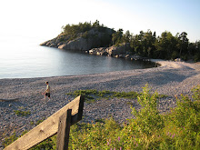
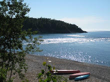
The terrain was flatter and we got to see some beautiful small beaches and bays on Lake Superior. Went in to see Agawa pictographs on the cliff face overlooking the water – in fact overhanging the water! Could not believe that they let people go out there without guard rails to protect them from falling into the lake! They did have 3 ropes anchored into the rocks and dangling into the water so if you do fall in you can pull yourself up on the ropes. The pictographs themselves are small and about 1500 years old.
We were passed by a family, parents on a tandem carrying everything in a small trailer and a 16 year old son on his bike carrying nothing but water. They are going across Canada about 200 km/day. The son made a point about them all being vegan. Whatever.
Then went up and down a very high and wide hill to reach our day’s destination which was the Twilight resort at Montreal River. Absolutely gorgeous spot right on Lake Superior with a rock beach and a resident bald eagle looking down on us.
I am enjoying seeing Canada 100 km at a time, but am looking forward to leaving northern Ontario mosquitoes and black flies!
Brenda
The terrain was flatter and we got to see some beautiful small beaches and bays on Lake Superior. Went in to see Agawa pictographs on the cliff face overlooking the water – in fact overhanging the water! Could not believe that they let people go out there without guard rails to protect them from falling into the lake! They did have 3 ropes anchored into the rocks and dangling into the water so if you do fall in you can pull yourself up on the ropes. The pictographs themselves are small and about 1500 years old.
We were passed by a family, parents on a tandem carrying everything in a small trailer and a 16 year old son on his bike carrying nothing but water. They are going across Canada about 200 km/day. The son made a point about them all being vegan. Whatever.
Then went up and down a very high and wide hill to reach our day’s destination which was the Twilight resort at Montreal River. Absolutely gorgeous spot right on Lake Superior with a rock beach and a resident bald eagle looking down on us.
I am enjoying seeing Canada 100 km at a time, but am looking forward to leaving northern Ontario mosquitoes and black flies!
Brenda
Subscribe to:
Posts (Atom)


.JPG)


.JPG)
.JPG)





.JPG)
.JPG)


.JPG)